Wednesday, April 1, 2015

Week 7: The Wild West

26-March
Whataroa River
We’re rolling along the Wild West Coast of New Zealand. The orographic rainfall here has to be measured in meters, producing a stretch of rain forest along the coastline. The roads are winding along the steep ocean-side cliffs, but ahead of us in the south snow-capped peaks emerge. The rivers now carry clear blue waters from the alpine glaciers, and we can see an abundance of deep kettle lakes. The Franz Josef Glacier is just visible hidden in its large valley, and sits high above the little town of the same name. After checking into our hostel, it was time for Pizza Night! All I could eat turned out to be about fourteen pieces.

27-March
Today is my long anticipated adventure to the Franz Josef Glacier! We joined the guides for an early start, and after gearing up we headed to the helicopter pad. This being my first time in a helicopter, it was quite exhilarating! We flew over the braided Waiho river and up-valley, where the glacier terminus lay in the middle of the rain forest, just 300 meters above sea level. Rock walls rose up, and we landed on a stretch of ice still in the shadow of the valley. Donning crampons and gloves, I set food on my very first glacier! Our walk took us up along a route through ice-fields, crevasses, ice arches, and boulder piles. The sun, finally coming into view, turned the ice a brilliant piercing blue, and began to melt small streams across the glacier surface. The scalloped faces of the ice reflected the sunlight, and even walking into a crevasse the blue light penetrated through the walls. The source of the Waiho river plummets from the edge of the glacier near the ice falls, and rainbows shone in the spray. This was the highest we could venture, since the ice falls is the fastest moving part of the glacier, with continuously shifting ice, as we saw that day. Before long our trek across this surreal landscape had to come to an end, and as Arnold would say, we had to “get to the choppa!” The afternoon was spent relaxing in the hot pools, at a balmy 40 degrees C.
MORE GLACIER PICTURES TO FOLLOW


28-March
Lake Wanaka road
Our journey continues south along the West Coast, and from the cliff road we see the Tasman Sea, with water stretching  farther continuously until you reach Patagonia. After a stop at Lake Matheson to see its famous reflective qualities, we followed Route 6 and the Haast River inland through the lowest of the passes through the Southern Alps. Huge cliffs towered on either side, and house-sized boulders were strewn across the valley floor from landslides. It is here that we are crossing the Alpine fault, which is pushing the Southern Alps even higher while stretching the South Island. Within an hour we had moved from the coastal rain forest into beech forest, which dominates New Zealand’s alpine environments. This soon gave way to dry grasslands with sparse trees in the rain shadow created by the mountains. The morning’s rain disappeared as well behind the mountains, and the sun illuminated golden fields, dusky mountains, and two of NZ’s largest lakes: Wanaka and Hawea. These were carved out by glaciers in the last global ice age, whose terminal moraines dammed the valleys and provided the foundation for the town of Wanaka. In the early evening I climbed Mt Iron for views of the region through light drizzle. 

Lake Hawea
Kawarau River bungy
29-March
Departing Wanaka across the countryside to Queenstown, we learned about the region’s history during the gold rush, which basically funded the construction of the rest of the country. The rugged mountains could belong in the American West, and stories of miners, outlaws, and gold towns don’t seem at all out of place here. The Kawarau River was previously known as the “golden river”, but now is best known as the site of the first commercial bungy jump. We cheered on our comrades as they overcame their fears of jumping off a bridge. The arid region is also famous for its award winning pinot noir. It’s off to Queenstown! Known formally as the adventure capital of the world, if you’re looking for ridiculous things to jump off of, you can find it here. Tonight we explored the city’s famous nightlife and quirky bars.

30-March
Milford Sound is known by some as the 8th natural wonder of the world, and is our destination today. We hit the road before sunrise, and the long drive from Queenstown was the highlight of the day due to the fantastic views expanding before us. Approaching the Daren Mountains the clouds rolled in, producing a bizarre landscape with towering cliffs disappearing into the mist, cool mountain streams, and unmelted snow fields atop the saddles. The valley ended in a shear granite face, where we entered the 1km Homer Tunnel to exit on the Milford side. Stopped at The Chasm; a roaring mountain stream carving its way into the granite. Our boat awaited us in the harbor for a cruise on the fjord. Despite the rain and clouds, we saw waterfalls, huge cliffs coming straight out of the water, U-shaped glacial valleys, and more seals! We even dunked the fore-deck in a waterfall for a refreshing shower. 
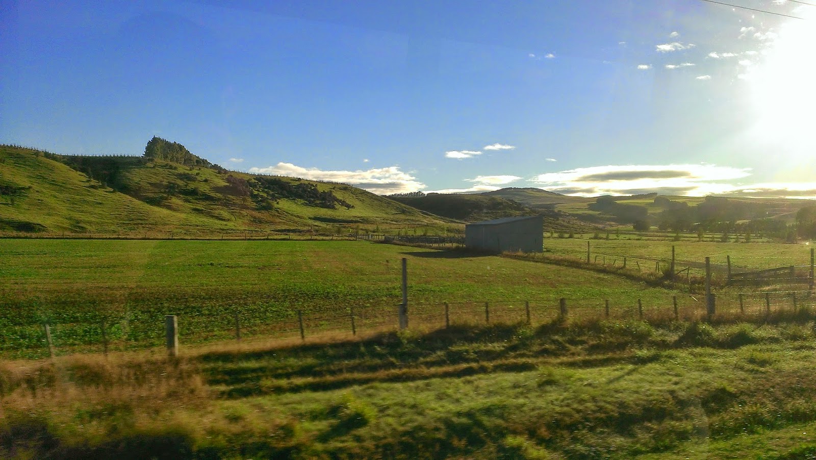
 Countryside drive and the Darren Mountains

The Maiden of Milford and Milford Sound


Photo: Shotover Jet
31-March

 As I’ve said, if its ridiculous or downright insane, it was probably invented in NZ. Example: the jet boat. On this brisk and sunny morning I’m embarking on the Shotover River on one wild ride. With double jet engines it can cruise at 85 km/hr in as low as 10cm of water. The water of the river was so clear the bottom appeared right beneath us, and we suddenly zoomed into the Shotover canyon, drifting corners with cliffs on either side. The driver pulled some 360 degree turns, splashing water everywhere. The wind chill nearly froze my face, but I was too focussed on the cliffs whipping by. Round 2? Better the second ride. Back in the city riding my adrenaline rush I tackled the famous Fergburger, inducing some solid napping later. 
Kiwi Bus on the way to Milford Sound

Tuesday, March 31, 2015

Week 6: The Adventure Continues

20-March
1100
Log: Residing at the YMCA, Hereford St., Christchurch
I’ve realized the glory in sleeping a full-night’s sleep. Compared to my old bunk, this hostel dorm room is spacious and luxurious, with a complimentary kitchen and lounge area. The budget eating has begun, but for now pasta will do me just fine. For those unaware, the city of Christchurch was devastated by a series of strong earthquakes in 2010, and much of the rubble remains. Still though, there’s a lot to see, including the Re-Start mall built out of shipping containers, the museum, and the botanical gardens. I’m ready for the beginning of the next adventure!

21-March
0730
Log: Kiwi Experience bus departs Christchurch, bound for Kaikoura Peninsula along NZ Rt 1
The sun rises over Christchurch as our bus pulls out of the city and rolls through golden fields, river beds, and lots of sheep. Mountains form the backdrop to the landscape, and after we cross the Hundalee Hills the highway skirts the Pacific Ocean, shining and gently lapping at the shore. The town of Kaikoura is very small, just occupying the northern part of the peninsula, and is dominated by the business of whale and dolphin watches that leave from here for the fertile waters offshore. My last view of the peninsula was almost two weeks ago, from the sea, where we failed to find any whales. After checking into our hostel, I went on a walk around the peninsula, admiring the huge wave-cut terrace extending into the sea and the shear cliffs of sloping rock layers.
Golden fields and the Kaikoura Range
Wave cut terrace and Whaler's Bay, Kairkoura Peninsula
22-March
0900
Log: Bus bound for Picton, then to Nelson region and Kaiteriteri by way of NZ Rt 6.
Sneaking out of bed, I was able to catch my last sunrise over the Pacific for quite a while. The sun illuminated the far mountains, reflected brilliant colors on the clouds and off the water, and gleamed through the surf. We made a pitstop at the Ohau Point Seal Colony, proceeding then to Picton and the ferries from Wellington. With a bus-full of fellow travelers, we spent the rest of the day driving to the gateway to Abel Tasman National Park in the town of Kaiteriteri. Blink and you’ll miss it, but it has all the water-taxi services into the park, one lodge and bar, and, well, not much else really. Kaiteriteri in the native language means plenty of food. I suppose leftovers will have to do.

Pacific sunrise and NZ Fur Seal
23-March
Sea Shuttle
1030
The weather much improved, I bought a ticket into the park and walked the gangway onto the water-taxi beached by the lodge. Zooming past Split Apple Rock and granite cliffs entering the sea, the fog and clouds rise in columns from the jungle. I suppose you could call it jungle, since it has surplus of ferns, vines, moss, and trees, though temperate rain forest might be more appropriate. The local granite doesn’t stand up well to the rain that precedes a rain forest, and the iron from the rock stains the quartz grains a brilliant color, giving rise to the golden beaches that Abel Tasman is famous for. It’s a small world, because as I strolled around a bend in the trail out pops three of my shipmates! They tell of more behind them, or ahead? They’re not quite sure, but I hear of their adventures since departing the ship just four days ago. Later, I stopped for lunch at a deserted golden beach, with only rocks driftwood and fern trees for company. I eventually made my way to Anchorage Bay and a taxi back to the hostel, where I met up with my shipmates to catch up.
Golden beaches in Kaiteriteri
My essential guide
The hops have been harvested
24-March
1100
Log: Bus proceeds to the wild West Coast and the town of Westport, through the windy roads following the Buller River.
Farewell to the golden beaches, orchards, and the country’s two favorite crops: grapes and hops. A brief stop at the Nelson Lakes gives preview to the mountains and rugged terrain to come, here mountain streams soon become mighty rivers, thanks to the ridiculous annual rainfall here. The Wet Coast profited from the abundant gold that these rivers carried. The Buller River flattens and our bus pulls into the little town of Westport. I rounded up some backpackers for the trek to the beach, where mountains of driftwood fed our bonfire, the water retreated far out along the sand flats, and the stars shined.

 The Nelson Lakes and meet my new wheels!
Westport Beach festivities
25-March
Me at the Pancake Rocks! Limestone and mudstone layers
An early walk along Cape Foulwind, where Captain Cook himself encountered foul winds one time, featured sea-stacks, wind-battered brush, and seals swimming amongst the kelp and rocks. The heavy surf explained the bizarre geological features we saw at the Punakaiki Pancake Rocks: layers of alternating lime- and mud-stone that have been carved into sea-stacks, sea-caves, sea-arches, and lots of other things done by the sea. But mostly, they looked like stacked pancakes. We now get the sense that those on the West Coast are very creative with names. We stopped in Greymouth, at the mouth of the…yes, the Grey River, for a tour of the Speight’s Brewery. The road later featured more firsts: a single lane road-bridge that also shares the train tracks, and a round-about with train tracks through the middle of it. Though these tracks probably carry the beer produced here, they mostly carry the products of the dairy industry. Tonight we were welcomed to a Kiwi Experience legend: the Mahinapua Hotel, where years and years of Kiwi buses have stopped in the middle of nowhere to share a dinner, a drink, and a great time.


Monday, March 30, 2015

Week 6: The Final Voyage


15-March
Ship’s Log: All secure alongside Birch St. Wharf.
Ship’s Position: 45°52.8’S 170°30.4’E, Voyage 1751 nm
Our last day in Dunedin. Unexpected weather courtesy of Cyclone Pam has kept us in port, but it’s the opportunity to have a final field day and clean up from the thousand feet who had tramped our soles. A sole cleansing is good for soul cleansing. Assignment deadlines are quickly approaching, and many of us our wrapping up our research papers to turn in. Lauren’s cooking never ceases to amaze: meatloaf! Our final episode of landlubbing included an adventure to the botanical gardens.
Look we're famous! (Photo credit Geoffry White)

16-March
Emily and Chris in foul'ies
1315
Ship’s Log: C watch has the deck, steering 325 psc. 1330: gybed to 020 on a starboard tack, passed the stays’s. Wind SSW F4, seas S 2ft, lookout posted forward
Ship’s Position: 45°47.1’S 170°43.3’E, Exiting Otago Harbor, Voyage 1762 nm
A delayed departure due to heavy rain allowed us to present our oceanographic research projects down below. All hands in foul’ies at GQ to get underway. The passage was not as magnificent as coming into the harbor with the fog and clouds, but at the mouth of the harbor C watch took the deck and set the sails, catching the cool southern breeze. It was a cold and windy watch, but it felt good to be sailing again.

Crew ready for weather, mollymook swooping
17-March
0300
Ship’s Log: Steering 055 psc under stays’s and stormtrys’l. Speed 6.7 kt, winds S F6, seas SSW 6’, clouds 8/8.
Ships’s Position: 45°04.7’S 172°23.8’E, 59 nm of Oamaru Harbor, Voyage: 1847 nm
1900
Ship’s Log: Steering 060 psc under stays’ls, speed 7.2 kts, wind SW F7, seas SW 8-10’, clouds 4/8.
Ship’s Position: 44°36.6’S 173°17.1’E, 45nm SxE of Banks Peninsula, Voyage: 1907 nm
Final Dawn Cleanup this morning, the wind has been picking up over the day, and at several points we were hove to in order to change sail plans, including the setting of the stormtrys’l, a small sail that takes the place of the main and is easier to handle in heavy weather. After a while of drifting, we set our compass for north again, the ship was taking some rollers of up to 30 degrees! Waves crash over the side, and in the darkness the deck blinks with flashes from the upset copepods. Several hours after sunset, our mate Stu soon realized the horizon was still illuminated with an eerie green glow. We soon realized we were seeing the aurora australis! Green yellow and red bands came out from behind the clouds, and many on deck simply stared south in awe.  

Rainbow off the Banks Peninsula

18-March
0700
Helm star Helen!
Ship’s Log: Steering 240, Motoring at 1350 rpm. Winds F5, seas SW 3ft, 5/8 Cu/Ci, rain
Ship’s Position: 43°49.3’S 173°22.8’E, 13nm from Lyttleton Pilots Station, Voyage: 1982 nm
Per usual, C watch is ready to bring the Seamans into port. We spent the morning furling sails, downrigging safety lines, and doing wakeups. At lookout I got blasted by sideways rain, but off to port was the Banks Peninsula, with rare spots of sunlight on the hills, and a rainbow ahead guiding us to port. A pilot boarded the ship outside the entrance, as they maneuvered in the seas to come alongside. The rain eased as we were called to general quarters, and we performed a successful docking, hands to docklines and fenders. Unfortunately, our neighbor on the wharf is a bulk carrier of wood pulp, raining down in clouds of dust upon the home we so pridefully kept clean and shiny. Tonight an emotional swizzle (farewell party) included a toast to Neptune by our captain Eliot, singing, poetry, acting, and ship-trivia. Standing my last dock watch, I navigated the maze of the engine room and said goodbye to the nooks and crannies of my little home, not quite ready to disembark into the wider world.

Swizzle party with MC's Matt and Chris, Eliot's trivia

C watch! (photo Helen Dufel)
19-March
0900
Ship’s Log: Ship secure in Lyttleton Harbor, Class S257 Departs Ship
Ship’s Position: 43°36.3’S 172°43.2’E, Voyage: 2005 nm
Today marks the last of Lauren’s cooking, a farewell to my cramped bunk, and a condemnation to dry land. Luckily, my shipmates and I shared a rainbow over the quarterdeck wishing us well, group pictures on the foredeck, and goodbyes to the crew who taught us so much. All of us are bound for Christchurch, where the final farewells would eventually take place, but we all crammed into a bus to leave our floating home behind, soon to be loved by a new group of sailors, who will keep her shipshape and mung-free. These farewells aren’t forever, since we are all sure to cross paths again back home, but it seems that the voyage has come to an end, and I nor anyone else is likely to be the same again after our adventure on the sea.


Thursday, March 19, 2015

Week 5: South we go!

10-March
1300
Ship’s Log: Motorsailing 8 kts at 1400 rpms under the stays’ls and the single reefed main, c/o 185 psc, NW’ly winds F1, seas 3 ft SSE, 29 nm off Banks Peninsula
Ship’s Position: 45°11.2’S 171°56.9’E, 29 nm off Banks Peninsula, Voyage 1566 nm
Had a science-filled mid watch last night, followed by a very kingly sleep of kings: Probably the longest continuous sleep I’ve had in a while. The seas are glassy and we are motorsailing south, bound for Dunedin. We found a feathered stowaway from land: a sparrow of some sort, who is very comfortable sitting on the members of the watch. Flocks of seabirds bob in the water and physalia physalia (man-of-wars) float by. Seals were even spotted poking their flippers from the water to wave hello, or as Richard tells us, cool off. At lookout I scanned the infinite horizons.
Chris and Jill going aloft, and B watch hauling up the mains'l.

11-March
1900
Ship’s Log: Sailing under the prevented main, stays’ls, jib JT and tops’l on a port tack. Winds F1 from the ENE and seas 3’ from the S. c/o 195 psc. (TH)
Ship’s Position: 45°11.9’S 171°30.0’E, 30 nm ENE of Katiki Point, Voyage: 1681 nm
Land is out of sight, only visible by its glow in the early morning hours. It’s remarkable how easy it is to study down below and forget that on deck we’re in the middle of the ocean. Only making about a knot, I was sitting in the bowsprit as a pod of dusky dolphins swam up. They played in front of the ship and passed around pieces of kelp between their flippers. Through the net I could see them swimming in the blue-green waters, with the suns rays penetrating the depths. Later, we were buzzed by a fishing vessel, bringing in tow hundreds and hundreds of sea birds hoping for lunch, and we saw mollymooks and albatrosses swooping all around our ship. Richard finally helped me tell the difference between them. Tonight I took the role of Junior Watch Officer and assumed control of my watch, with our mate Stu to help me balance all the duties we fill in just four hours.

Dolphins swimming under the headrig.

 Birds flocking around a fishing vessel, and a mollymook.

12-March
0700
Ship’s Log: Motorsailing under stays’s, 1000 rpm, spd. 6 kts, c/o 220 psc, Wind NxW F3. 
Ship’s Position: 45°42.1’S 170°49.5’E, 6 nm E of Hayward Pt, Voyage: 1730 nm
Today C watch took the deck to (again) bring the Seamans to port. We reached the mouth of Otago Harbor just before turnover, and we took two hours or so to navigate the long and winding channel between the Otago Peninsula and the mainland. Quaint villages dotted the coast, with rolling green hills covered in sheep. Cars parked along the coast hailing the Seaman’s return to Dunedin, and in the distance the gothic spires of the city and warehouses and tanks of the waterfront came into view. Like sailing pros, we banged a u-ey in the basin and pulled to the dock, starboard side to.

The sun rising behind the Otago Peninsula, and Port Chalmers in Otago Harbor

13-March
0700
Ship’s Log: Alongside, stbd side to, at Birch St. Wharf Dunedin, ship all secure. 
Ship’s Position: 45°52.8’S 170°30.4’E, Voyage 1751 nm
Picked up a bus and met our friend Adelle from the U of Otago in Portabello, and headed along the windy harborside roads to the yellow-eyed penguin shelter and hospital, where we saw penguins molting and seals basking on the rocks. We also visited the Royal Albatros colony at the mouth of the harbor, and shipmates took a swim at Pilots Beach. A detour took us up steep and winding dirt roads up the mountains to a place called Lover’s Leap. Only having 15 minutes, we had to sprint a km through rain and windswept trees and confused sheep to the shear cliff-face with columnar basalt and the roaring sea below.

Yellow Eyed penguin and the Otago shoreline.

14-March
0000
Ship’s Log: All secure alongside Birch St. Wharf.
Ship’s Position: 45°52.8’S 170°30.4’E, Voyage 1751 nm

Today we spruced the Seamans up for Open Ship Day, where we invited the citizens of Dunedin to come tour a tall ship. The queue was full by 10:00, and by 1:00 500 people had come aboard, with many children hoping to be pirates. I also visited the University of Otago campus, which had awesome architecture and green spaces. The crew and faculty rendezvoused at Speights Brewery for a group dinner together. 

Shipmates at Pilots Beach